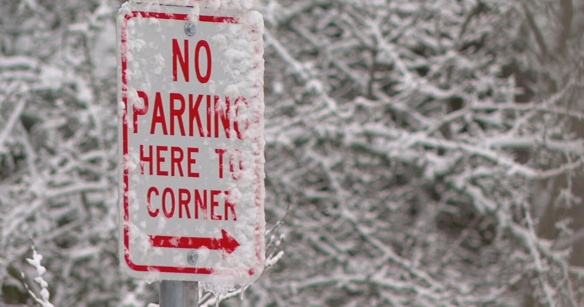
How much snow will Boston and the rest of Massachusetts get this weekend?
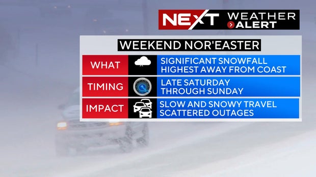
BOSTON - The WBZ Weather Team is continuing the NEXT Weather Alert for all of southern New England as the most impactful snowstorm in a few years is now just days away.
Forecast confidence has increased and it appears we are in for a widespread, plowable snowstorm on Sunday.
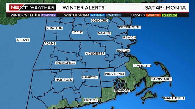
The National Weather Service has also issued a Winter Storm Watch Saturday night through Sunday for all areas north and west of Boston.
When will it snow in Massachusetts?
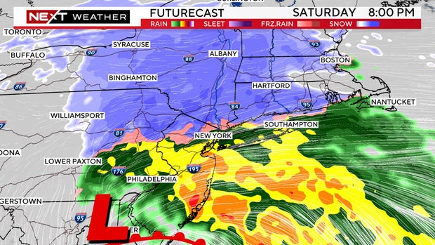
Saturday daytime/evening: Some light, ocean-effect snowfall may occur at times, especially near the coastline with splashes of rain mixed in. However, no significant impact is expected during the daylight hours on Saturday.
Storm arrives:
Late Saturday afternoon into the early evening with mainly snow in central to western Massachusetts.
After 9 p.m., the heft of the snowfall moves towards eastern Mass.
Once the snow arrives it will come down fairly heavy right away and continue through Sunday morning. Snowfall rates in some heavier bands could reach or top 1" per hour.
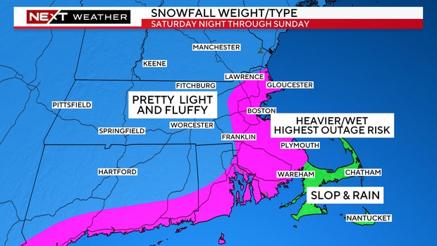
The farther inland you live, the lighter and fluffier the snow.
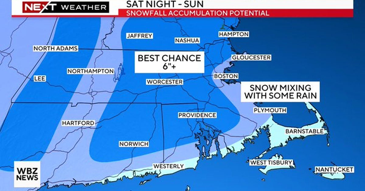
Closer to the coastline, temperatures will be closer to 32 degrees and the snow will be much heavier/wetter. It may even mix with rain at times at the immediate shore. This is the region we are most concerned about getting some scattered power outages given the pasty snow and gusty wind.
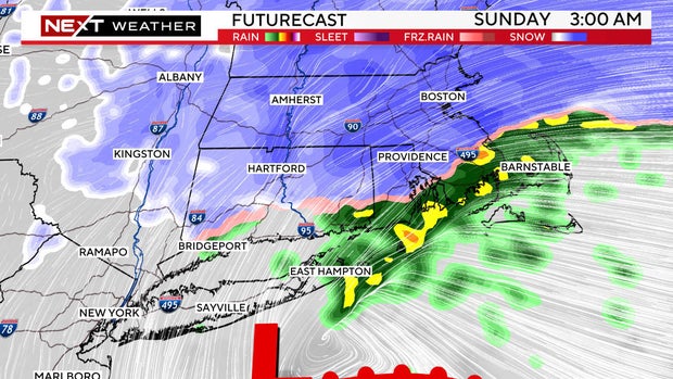
Out over Cape Cod and the Islands, it will be mainly rain until the winds turn more northerly late in the storm on Sunday.
Final flakes/Time to clean up:
It will snow for most of the day on Sunday. The intensity will begin to lessen later in the afternoon. We expect the accumulating snow to come to an end from west to east Sunday evening between 6 and 8 p.m. in eastern Mass., a bit earlier in western and central Mass.
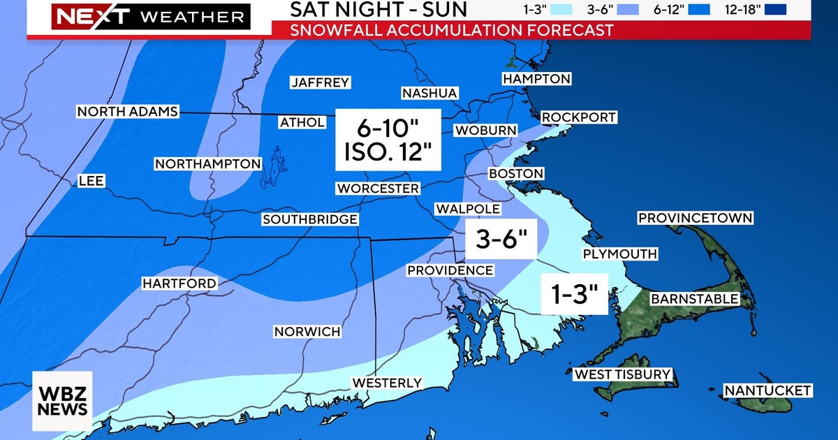
How much snow will Boston get?
Final snowfall amounts:
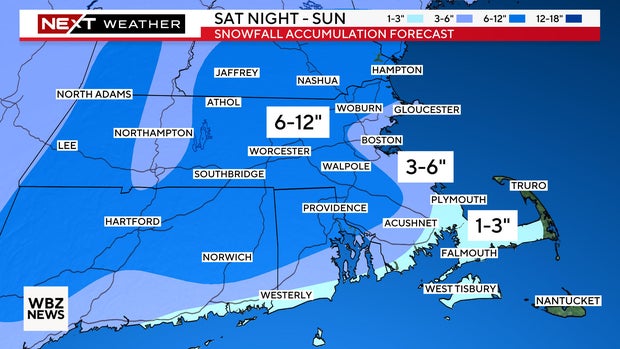
6-12" Just inland from the coastline, west of I-95
3-6" Along the immediate coastline from Cape Ann to Boston to the South Shore (heavy and wet)
1-3" South Coast to the Cape Cod Canal to the mid-Cape (mainly slop and slush)
Very little (if any) Outer Cape and Nantucket
Any slight change to the track of the storm in the next 48 hours will lead to some tweaking of this snow map. We MAY need to add an area of 12"+ somewhere due to heavy banding once we get a closer look at some hi-resolution modeling which is starting to filter in now.
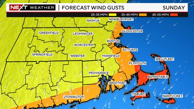
The winds will not be a huge factor away from the coastline. Northeast gusts will peak between 35-45 mph right at the shoreline and 45-55 mph over Cape Cod and the Islands. Certainly not the strongest wind event we have had in recent weeks, but perhaps enough to cause some outages in the heavy/wet snow areas.
Are there coastal flooding concerns in Massachusetts?
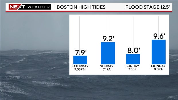
Tides are astronomically low this weekend. Therefore, the threat for any significant coastal flooding is low.
The times to watch would be the Sunday morning (7-8 a.m.) tide cycle along east-northeast facing beaches and the Sunday evening (7-8 p.m.) cycle in the more north-northeast facing beaches.
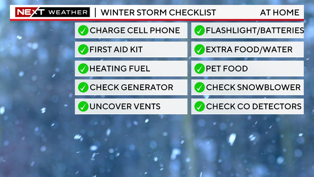
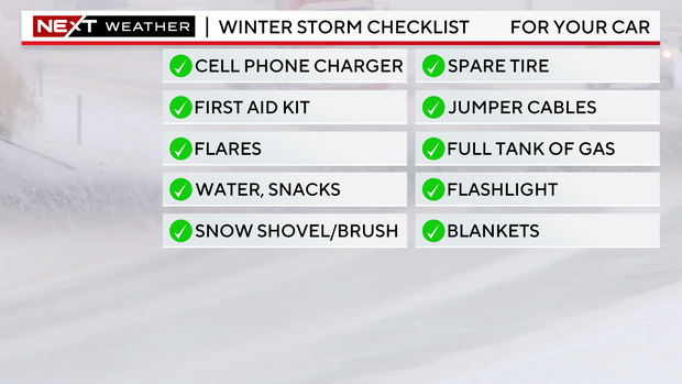
Finally, this seems like a good time to for a safety reminder.
Always better to be prepared.
In your home:
And in your car:
As always, our WBZ Weather team will have you covered for the entire event on WBZ-TV, WBZ.com and streaming on CBS News Boston.
for more features.
